


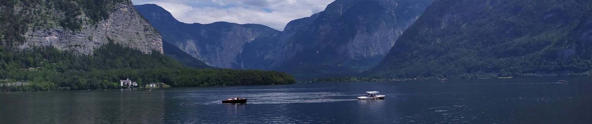
Hallstatt

Arnaud Dejean
User
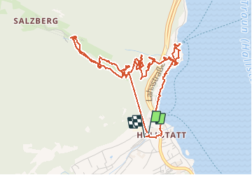

Length
6.3 km

Max alt
926 m

Uphill gradient
471 m
Km-Effort
12.6 km

Min alt
502 m

Downhill gradient
475 m
Boucle
Yes
Creation date :
2020-07-14 07:48:23.994
Updated on :
2020-07-14 13:38:32.645
2h56
Difficulty : Easy

FREE GPS app for hiking
 SityTrail
IGN / Geographical institutes
SityTrail Plus
The world is yours!
About
Trail Walking of 6.3 km to be discovered at Upper Austria, Bezirk Gmunden, Hallstatt. This trail is proposed by Arnaud Dejean.
Photos


Positioning
Country:
Austria
Region :
Upper Austria
Department/Province :
Bezirk Gmunden
Municipality :
Hallstatt
Location:
Unknown
Start:(Dec)
Start:(UTM)
398120 ; 5267808 (33T) N.
Comments