


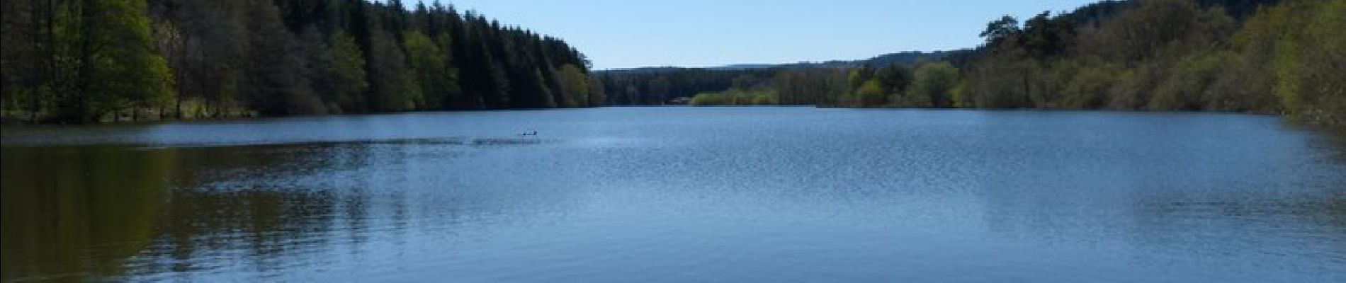
Étang de Riols

Gegetop
User
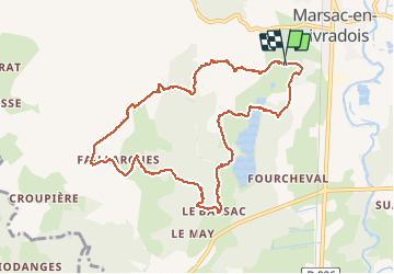

Length
10 km

Max alt
757 m

Uphill gradient
252 m
Km-Effort
13.3 km

Min alt
552 m

Downhill gradient
254 m
Boucle
Yes
Creation date :
2020-07-19 08:39:58.354
Updated on :
2020-08-09 17:44:39.275
2h39
Difficulty : Easy

FREE GPS app for hiking
 SityTrail
IGN / Geographical institutes
SityTrail Plus
The world is yours!
About
Trail Walking of 10 km to be discovered at Auvergne-Rhône-Alpes, Puy-de-Dôme, Marsac-en-Livradois. This trail is proposed by Gegetop.
Description
Pas toujours bien balisé...
Photos


Positioning
Country:
France
Region :
Auvergne-Rhône-Alpes
Department/Province :
Puy-de-Dôme
Municipality :
Marsac-en-Livradois
Location:
Unknown
Start:(Dec)
Start:(UTM)
556169 ; 5035918 (31T) N.
Comments