


Vattetot sur mer

Laurent53
User
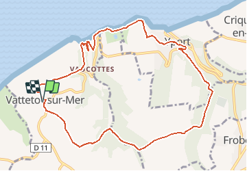

Length
10.4 km

Max alt
97 m

Uphill gradient
230 m
Km-Effort
13.5 km

Min alt
8 m

Downhill gradient
230 m
Boucle
Yes
Creation date :
2020-07-22 14:54:10.3
Updated on :
2020-07-22 14:57:26.082
--
Difficulty : Medium

FREE GPS app for hiking
 SityTrail
IGN / Geographical institutes
SityTrail Plus
The world is yours!
About
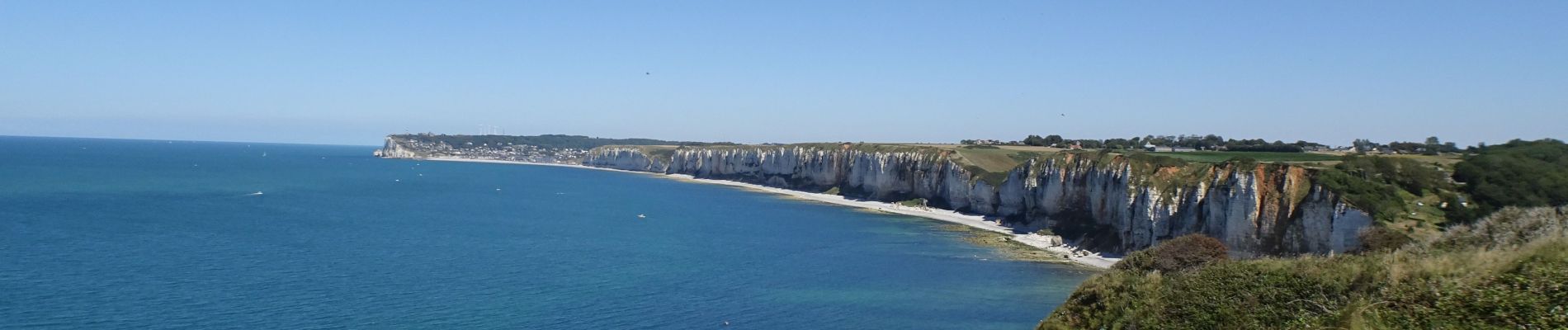
Trail On foot of 10.4 km to be discovered at Normandy, Seine-Maritime, Vattetot-sur-Mer. This trail is proposed by Laurent53.
Photos

Positioning
Country:
France
Region :
Normandy
Department/Province :
Seine-Maritime
Municipality :
Vattetot-sur-Mer
Location:
Unknown
Start:(Dec)
Start:(UTM)
303949 ; 5511940 (31U) N.
Comments