


lac vert lac noir Valmasque

jlnessy
User
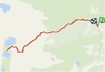

Length
14 km

Max alt
2288 m

Uphill gradient
633 m
Km-Effort
22 km

Min alt
1702 m

Downhill gradient
632 m
Boucle
Yes
Creation date :
2020-07-22 06:37:03.62
Updated on :
2020-07-23 23:45:39.646
6h16
Difficulty : Medium

FREE GPS app for hiking
 SityTrail
IGN / Geographical institutes
SityTrail Plus
The world is yours!
About
Trail Walking of 14 km to be discovered at Provence-Alpes-Côte d'Azur, Maritime Alps, Tende. This trail is proposed by jlnessy.
Positioning
Country:
France
Region :
Provence-Alpes-Côte d'Azur
Department/Province :
Maritime Alps
Municipality :
Tende
Location:
Unknown
Start:(Dec)
Start:(UTM)
379600 ; 4885640 (32T) N.
Comments