


Tour du Puy Chaumont

Gegetop
User
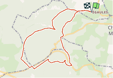

Length
11.6 km

Max alt
1007 m

Uphill gradient
233 m
Km-Effort
14.7 km

Min alt
817 m

Downhill gradient
232 m
Boucle
Yes
Creation date :
2020-07-24 09:10:52.153
Updated on :
2020-07-25 07:34:04.184
3h00
Difficulty : Easy
2h46
Difficulty : Easy

FREE GPS app for hiking
 SityTrail
IGN / Geographical institutes
SityTrail Plus
The world is yours!
About
Trail Walking of 11.6 km to be discovered at Auvergne-Rhône-Alpes, Puy-de-Dôme, Volvic. This trail is proposed by Gegetop.
Description
Toujours à l'ombre ! 😊
Photos

Positioning
Country:
France
Region :
Auvergne-Rhône-Alpes
Department/Province :
Puy-de-Dôme
Municipality :
Volvic
Location:
Unknown
Start:(Dec)
Start:(UTM)
500030 ; 5075954 (31T) N.
Comments