tavier moulin ac

colsonandre
User
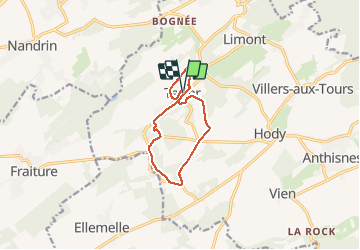

Length
9.1 km

Max alt
285 m

Uphill gradient
174 m
Km-Effort
11.5 km

Min alt
189 m

Downhill gradient
179 m
Boucle
Yes
Creation date :
2020-07-25 06:59:53.669
Updated on :
2020-07-25 12:40:57.594
3h22
Difficulty : Easy

FREE GPS app for hiking
 SityTrail
IGN / Geographical institutes
SityTrail Plus
The world is yours!
About
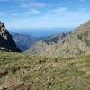
Trail Walking of 9.1 km to be discovered at Wallonia, Liège, Anthisnes. This trail is proposed by colsonandre.
Description
magnifique
Photos


Positioning
Country:
Belgium
Region :
Wallonia
Department/Province :
Liège
Municipality :
Anthisnes
Location:
Tavier
Start:(Dec)
Start:(UTM)
675248 ; 5596707 (31U) N.
Comments