


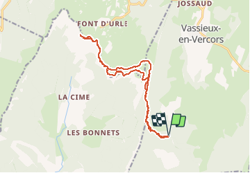
Vercors : fond d'urle depuis Vassieux, puis de la gagère

manumax
User

Length
18 km

Max alt
1643 m

Uphill gradient
797 m
Km-Effort
29 km

Min alt
1256 m

Downhill gradient
796 m
Boucle
Yes
Creation date :
2020-07-26 07:14:42.332
Updated on :
2020-07-27 22:46:52.92
6h02
Difficulty : Very easy

FREE GPS app for hiking
 SityTrail
IGN / Geographical institutes
SityTrail Plus
The world is yours!
About
Trail Walking of 18 km to be discovered at Auvergne-Rhône-Alpes, Drôme, Vassieux-en-Vercors. This trail is proposed by manumax.
Positioning
Country:
France
Region :
Auvergne-Rhône-Alpes
Department/Province :
Drôme
Municipality :
Vassieux-en-Vercors
Location:
Unknown
Start:(Dec)
Start:(UTM)
686057 ; 4970016 (31T) N.
Comments