


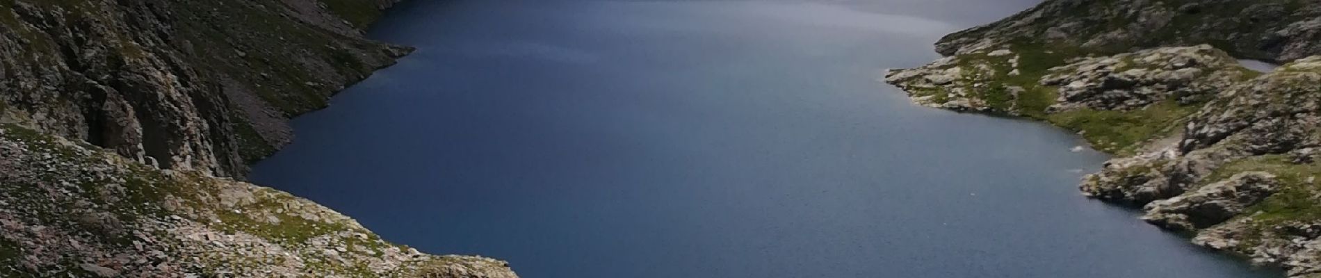
Lac et Pas d'Agnel

domi06
User
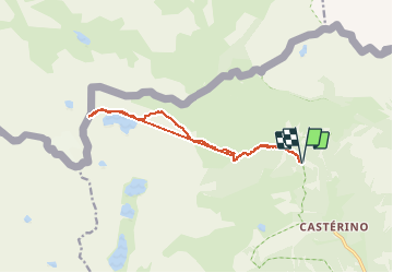

Length
13.8 km

Max alt
2553 m

Uphill gradient
933 m
Km-Effort
26 km

Min alt
1714 m

Downhill gradient
934 m
Boucle
Yes
Creation date :
2020-07-26 06:50:50.416
Updated on :
2020-08-13 13:50:52.18
5h12
Difficulty : Medium

FREE GPS app for hiking
 SityTrail
IGN / Geographical institutes
SityTrail Plus
The world is yours!
About
Trail Walking of 13.8 km to be discovered at Provence-Alpes-Côte d'Azur, Maritime Alps, Tende. This trail is proposed by domi06.
Description
Randonnée facile jusqu'au lac, montée régulière. Du lac au Pas, quelques passages délicats. Nombreux bouquetins.
Photos


Positioning
Country:
France
Region :
Provence-Alpes-Côte d'Azur
Department/Province :
Maritime Alps
Municipality :
Tende
Location:
Unknown
Start:(Dec)
Start:(UTM)
379672 ; 4885524 (32T) N.
Comments