


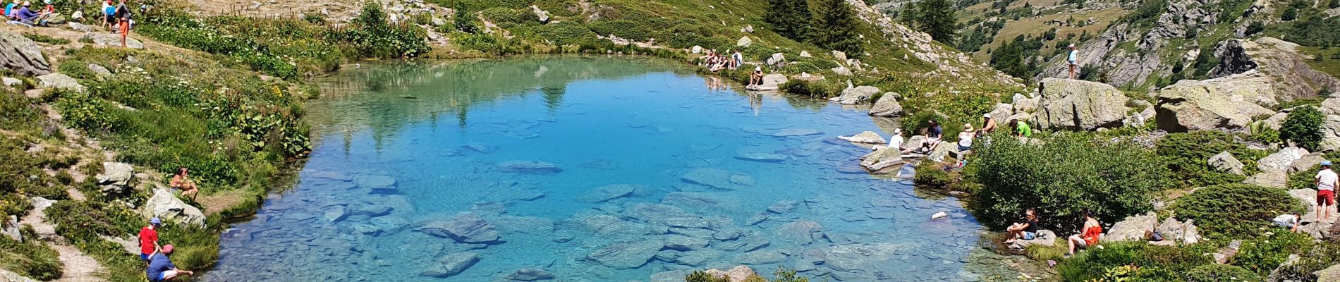
Valmeinier-Lac Vert

Sigmut
User
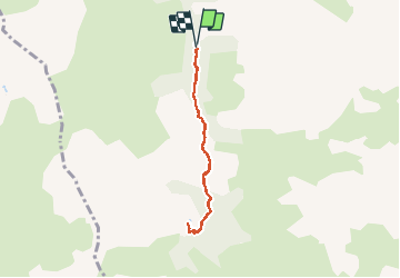

Length
6 km

Max alt
1995 m

Uphill gradient
246 m
Km-Effort
9.3 km

Min alt
1748 m

Downhill gradient
248 m
Boucle
Yes
Creation date :
2020-07-27 08:47:13.802
Updated on :
2020-07-30 21:41:12.111
3h37
Difficulty : Easy

FREE GPS app for hiking
 SityTrail
IGN / Geographical institutes
SityTrail Plus
The world is yours!
About
Trail Walking of 6 km to be discovered at Auvergne-Rhône-Alpes, Savoy, Valmeinier. This trail is proposed by Sigmut.
Description
Rando agréable mais beaucoup de monde. Faite avec un enfant de 3 ans et un de 5 ans.
Photos


Positioning
Country:
France
Region :
Auvergne-Rhône-Alpes
Department/Province :
Savoy
Municipality :
Valmeinier
Location:
Unknown
Start:(Dec)
Start:(UTM)
303085 ; 5003970 (32T) N.
Comments