


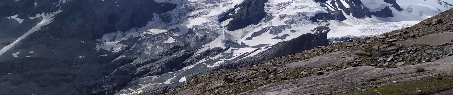
Gamgrubenweg

Arnaud Dejean
User
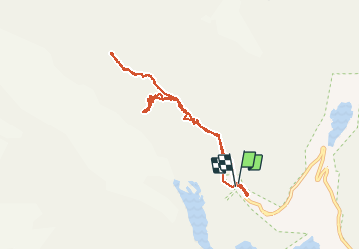

Length
8.5 km

Max alt
2554 m

Uphill gradient
627 m
Km-Effort
17 km

Min alt
2229 m

Downhill gradient
662 m
Boucle
Yes
Creation date :
2020-07-27 09:50:08.782
Updated on :
2020-07-27 14:50:11.05
3h13
Difficulty : Difficult

FREE GPS app for hiking
 SityTrail
IGN / Geographical institutes
SityTrail Plus
The world is yours!
About
Trail Walking of 8.5 km to be discovered at Carinthia, Bezirk Spittal an der Drau, Heiligenblut am Großglockner. This trail is proposed by Arnaud Dejean.
Photos


Positioning
Country:
Austria
Region :
Carinthia
Department/Province :
Bezirk Spittal an der Drau
Municipality :
Heiligenblut am Großglockner
Location:
Unknown
Start:(Dec)
Start:(UTM)
329266 ; 5216074 (33T) N.
Comments