


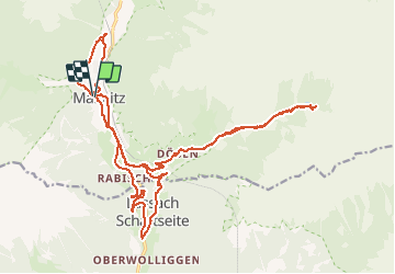
Mallnitz Dösener

Arnaud Dejean
User

Length
27 km

Max alt
1625 m

Uphill gradient
880 m
Km-Effort
39 km

Min alt
973 m

Downhill gradient
880 m
Boucle
Yes
Creation date :
2020-07-28 07:25:14.726
Updated on :
2020-07-28 09:47:53.401
2h18
Difficulty : Difficult

FREE GPS app for hiking
 SityTrail
IGN / Geographical institutes
SityTrail Plus
The world is yours!
About
Trail Mountain bike of 27 km to be discovered at Carinthia, Bezirk Spittal an der Drau, Mallnitz. This trail is proposed by Arnaud Dejean.
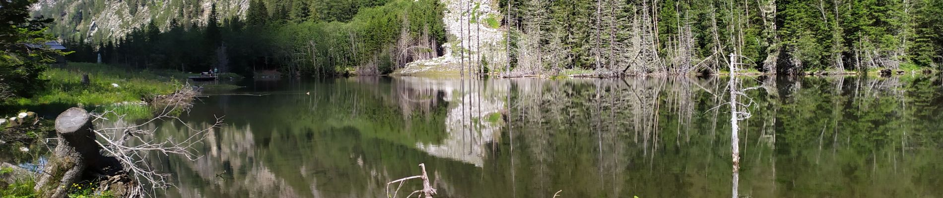
Photos


Positioning
Country:
Austria
Region :
Carinthia
Department/Province :
Bezirk Spittal an der Drau
Municipality :
Mallnitz
Location:
Unknown
Start:(Dec)
Start:(UTM)
360808 ; 5205545 (33T) N.
Comments