


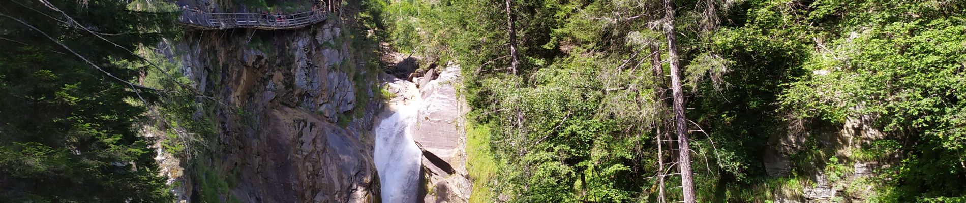
Groppensteinschlucht

Arnaud Dejean
User
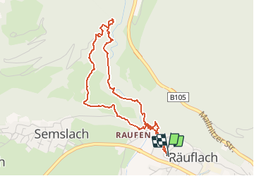

Length
4.6 km

Max alt
903 m

Uphill gradient
243 m
Km-Effort
7.8 km

Min alt
682 m

Downhill gradient
243 m
Boucle
Yes
Creation date :
2020-07-28 12:05:29.645
Updated on :
2020-07-28 14:06:17.064
1h42
Difficulty : Easy

FREE GPS app for hiking
 SityTrail
IGN / Geographical institutes
SityTrail Plus
The world is yours!
About
Trail Walking of 4.6 km to be discovered at Carinthia, Bezirk Spittal an der Drau, Obervellach. This trail is proposed by Arnaud Dejean.
Photos


Positioning
Country:
Austria
Region :
Carinthia
Department/Province :
Bezirk Spittal an der Drau
Municipality :
Obervellach
Location:
Unknown
Start:(Dec)
Start:(UTM)
361982 ; 5199868 (33T) N.
Comments