


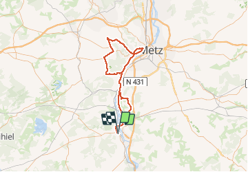
Cx St Clément-Mt St Quentin-Arry

PhilippeC54
User

Length
89 km

Max alt
355 m

Uphill gradient
1180 m
Km-Effort
105 km

Min alt
164 m

Downhill gradient
1183 m
Boucle
No
Creation date :
2020-07-28 11:19:39.248
Updated on :
2020-07-29 09:04:50.542
3h58
Difficulty : Medium

FREE GPS app for hiking
 SityTrail
IGN / Geographical institutes
SityTrail Plus
The world is yours!
About
Trail Road bike of 89 km to be discovered at Grand Est, Meurthe-et-Moselle, Pont-à-Mousson. This trail is proposed by PhilippeC54.
Positioning
Country:
France
Region :
Grand Est
Department/Province :
Meurthe-et-Moselle
Municipality :
Pont-à-Mousson
Location:
Unknown
Start:(Dec)
Start:(UTM)
283379 ; 5420480 (32U) N.
Comments