


Aérodrome Sud Meusien

flzanichelli
User

Length
4.8 km

Max alt
263 m

Uphill gradient
64 m
Km-Effort
5.6 km

Min alt
206 m

Downhill gradient
64 m
Boucle
Yes
Creation date :
2020-07-28 17:25:02.136
Updated on :
2020-07-28 17:55:00.365
29m
Difficulty : Very easy

FREE GPS app for hiking
 SityTrail
IGN / Geographical institutes
SityTrail Plus
The world is yours!
About
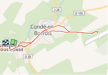
Trail Electric bike of 4.8 km to be discovered at Grand Est, Meuse, Les Hauts-de-Chée. This trail is proposed by flzanichelli.
Positioning
Country:
France
Region :
Grand Est
Department/Province :
Meuse
Municipality :
Les Hauts-de-Chée
Location:
Unknown
Start:(Dec)
Start:(UTM)
658256 ; 5414627 (31U) N.
Comments