


mercier

crocau
User
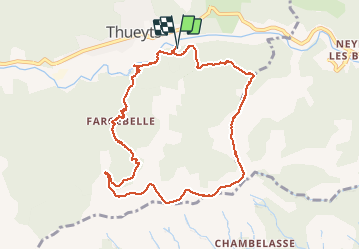

Length
10.4 km

Max alt
946 m

Uphill gradient
605 m
Km-Effort
18.4 km

Min alt
371 m

Downhill gradient
605 m
Boucle
Yes
Creation date :
2020-07-21 10:39:29.183
Updated on :
2020-07-30 09:28:24.386
4h46
Difficulty : Medium

FREE GPS app for hiking
 SityTrail
IGN / Geographical institutes
SityTrail Plus
The world is yours!
About
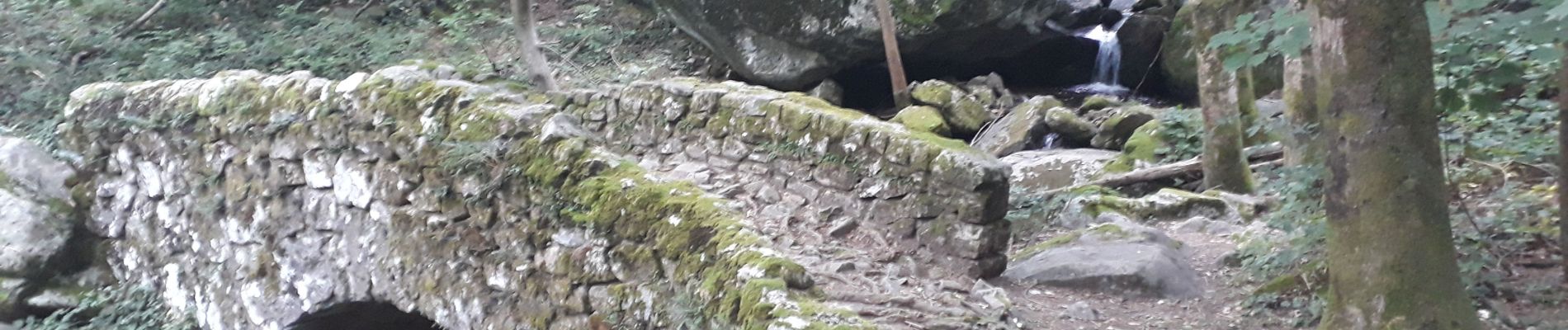
Trail Walking of 10.4 km to be discovered at Auvergne-Rhône-Alpes, Ardèche, Thueyts. This trail is proposed by crocau.
Photos


Positioning
Country:
France
Region :
Auvergne-Rhône-Alpes
Department/Province :
Ardèche
Municipality :
Thueyts
Location:
Unknown
Start:(Dec)
Start:(UTM)
597429 ; 4947434 (31T) N.
Comments