


Pic de la Soucarrane

c.chehere
User
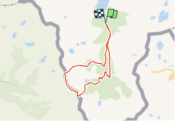

Length
13.9 km

Max alt
2881 m

Uphill gradient
1290 m
Km-Effort
31 km

Min alt
1637 m

Downhill gradient
1291 m
Boucle
Yes
Creation date :
2020-07-31 07:15:05.227
Updated on :
2020-08-29 07:51:55.063
6h04
Difficulty : Difficult

FREE GPS app for hiking
 SityTrail
IGN / Geographical institutes
SityTrail Plus
The world is yours!
About
Trail Walking of 13.9 km to be discovered at Occitania, Ariège, Auzat. This trail is proposed by c.chehere.
Description
Au départ de l 'orris de carla
Positioning
Country:
France
Region :
Occitania
Department/Province :
Ariège
Municipality :
Auzat
Location:
Unknown
Start:(Dec)
Start:(UTM)
372806 ; 4723824 (31T) N.
Comments