


Fleurier - La Chaux-du-Milieu

bffcuc
User
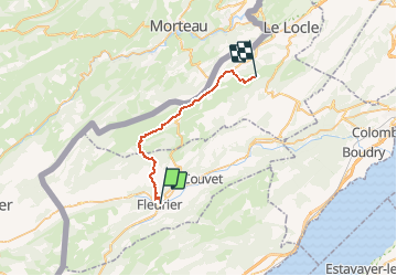

Length
24 km

Max alt
1243 m

Uphill gradient
771 m
Km-Effort
34 km

Min alt
738 m

Downhill gradient
433 m
Boucle
No
Creation date :
2014-12-11 00:00:00.0
Updated on :
2014-12-11 00:00:00.0
4h12
Difficulty : Unknown

FREE GPS app for hiking
 SityTrail
IGN / Geographical institutes
SityTrail Plus
The world is yours!
About
Trail Walking of 24 km to be discovered at Neuchâtel, Unknown, Val-de-Travers. This trail is proposed by bffcuc.
Positioning
Country:
Switzerland
Region :
Neuchâtel
Department/Province :
Unknown
Municipality :
Val-de-Travers
Location:
Unknown
Start:(Dec)
Start:(UTM)
315869 ; 5197418 (32T) N.
Comments