


7980268

jeanboulay
User
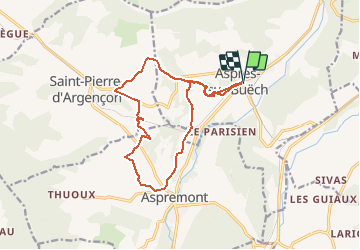

Length
15.6 km

Max alt
921 m

Uphill gradient
361 m
Km-Effort
20 km

Min alt
719 m

Downhill gradient
360 m
Boucle
Yes
Creation date :
2020-07-31 12:53:13.689
Updated on :
2020-07-31 12:53:13.689

FREE GPS app for hiking
 SityTrail
IGN / Geographical institutes
SityTrail Plus
The world is yours!
About
Trail of 15.6 km to be discovered at Provence-Alpes-Côte d'Azur, Hautes-Alpes, Aspres-sur-Buëch. This trail is proposed by jeanboulay.
Positioning
Country:
France
Region :
Provence-Alpes-Côte d'Azur
Department/Province :
Hautes-Alpes
Municipality :
Aspres-sur-Buëch
Location:
Unknown
Start:(Dec)
Start:(UTM)
718719 ; 4933448 (31T) N.
Comments