


le-ruisseau-des-combes-a-vtt

jeanboulay
User
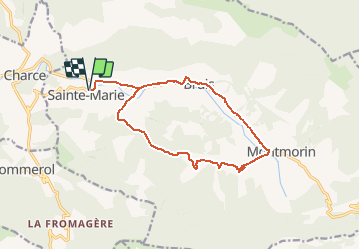

Length
14.8 km

Max alt
835 m

Uphill gradient
231 m
Km-Effort
17.9 km

Min alt
646 m

Downhill gradient
231 m
Boucle
Yes
Creation date :
2020-07-31 12:53:26.251
Updated on :
2020-07-31 12:53:26.251

FREE GPS app for hiking
 SityTrail
IGN / Geographical institutes
SityTrail Plus
The world is yours!
About
Trail of 14.8 km to be discovered at Provence-Alpes-Côte d'Azur, Hautes-Alpes, Valdoule. This trail is proposed by jeanboulay.


Positioning
Country:
France
Region :
Provence-Alpes-Côte d'Azur
Department/Province :
Hautes-Alpes
Municipality :
Valdoule
Location:
Unknown
Start:(Dec)
Start:(UTM)
696929 ; 4926632 (31T) N.
Comments