


32124-cirkwi_circuit_entre_2_rives

jeanboulay
User
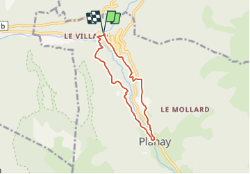

Length
5.7 km

Max alt
1210 m

Uphill gradient
353 m
Km-Effort
10.4 km

Min alt
890 m

Downhill gradient
349 m
Boucle
Yes
Creation date :
2020-07-31 12:56:17.421
Updated on :
2020-07-31 12:56:17.421

FREE GPS app for hiking
 SityTrail
IGN / Geographical institutes
SityTrail Plus
The world is yours!
About
Trail of 5.7 km to be discovered at Auvergne-Rhône-Alpes, Savoy, Planay. This trail is proposed by jeanboulay.
Positioning
Country:
France
Region :
Auvergne-Rhône-Alpes
Department/Province :
Savoy
Municipality :
Planay
Location:
Unknown
Start:(Dec)
Start:(UTM)
318933 ; 5034796 (32T) N.
Comments