


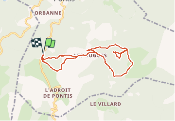
Pontis Le Morgonnet 9km

thonyc
User GUIDE

Length
8.9 km

Max alt
1740 m

Uphill gradient
453 m
Km-Effort
15 km

Min alt
1306 m

Downhill gradient
450 m
Boucle
Yes
Creation date :
2020-08-01 07:00:05.73
Updated on :
2020-08-02 17:04:55.014
3h15
Difficulty : Medium

FREE GPS app for hiking
 SityTrail
IGN / Geographical institutes
SityTrail Plus
The world is yours!
About
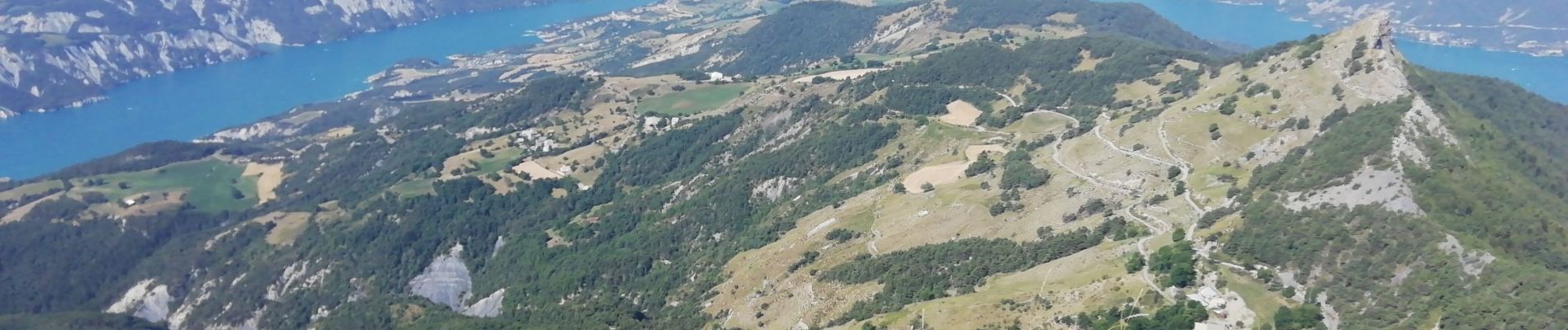
Trail Walking of 8.9 km to be discovered at Provence-Alpes-Côte d'Azur, Alpes-de-Haute-Provence, Pontis. This trail is proposed by thonyc.
Photos


Positioning
Country:
France
Region :
Provence-Alpes-Côte d'Azur
Department/Province :
Alpes-de-Haute-Provence
Municipality :
Pontis
Location:
Unknown
Start:(Dec)
Start:(UTM)
289295 ; 4929726 (32T) N.
Comments
belle petite rando, points de vue magnifiques.....à refaire.