


Valmeinier-Aire des Lières

Sigmut
User
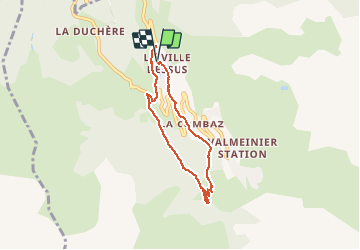

Length
5.8 km

Max alt
1672 m

Uphill gradient
200 m
Km-Effort
8.5 km

Min alt
1480 m

Downhill gradient
205 m
Boucle
Yes
Creation date :
2020-08-01 09:31:39.685
Updated on :
2020-08-02 22:15:41.182
2h08
Difficulty : Very easy

FREE GPS app for hiking
 SityTrail
IGN / Geographical institutes
SityTrail Plus
The world is yours!
About
Trail Walking of 5.8 km to be discovered at Auvergne-Rhône-Alpes, Savoy, Valmeinier. This trail is proposed by Sigmut.
Description
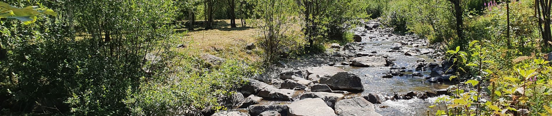
Joli coin de baignades. Marche avec enfants de 3 et 5 ans.
Photos


23 photos in total. Please click on a photo to see them all in the gallery.
Positioning
Country:
France
Region :
Auvergne-Rhône-Alpes
Department/Province :
Savoy
Municipality :
Valmeinier
Location:
Unknown
Start:(Dec)
Start:(UTM)
302062 ; 5006709 (32T) N.
Comments