


Luberon Les Borrys-Rochers des 11h

Bredu
User
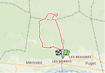

Length
14 km

Max alt
674 m

Uphill gradient
654 m
Km-Effort
23 km

Min alt
153 m

Downhill gradient
654 m
Boucle
Yes
Creation date :
2014-12-10 00:00:00.0
Updated on :
2014-12-10 00:00:00.0
5h30
Difficulty : Medium

FREE GPS app for hiking
 SityTrail
IGN / Geographical institutes
SityTrail Plus
The world is yours!
About
Trail Walking of 14 km to be discovered at Provence-Alpes-Côte d'Azur, Vaucluse, Puget. This trail is proposed by Bredu.


Positioning
Country:
France
Region :
Provence-Alpes-Côte d'Azur
Department/Province :
Vaucluse
Municipality :
Puget
Location:
Unknown
Start:(Dec)
Start:(UTM)
680025 ; 4847518 (31T) N.
Comments