


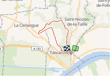
tancarville 76 10k

Laurent53
User

Length
10.2 km

Max alt
117 m

Uphill gradient
153 m
Km-Effort
12.2 km

Min alt
6 m

Downhill gradient
153 m
Boucle
Yes
Creation date :
2020-08-03 07:05:54.467
Updated on :
2020-08-03 07:06:48.151
--
Difficulty : Very easy

FREE GPS app for hiking
 SityTrail
IGN / Geographical institutes
SityTrail Plus
The world is yours!
About
Trail On foot of 10.2 km to be discovered at Normandy, Seine-Maritime, Tancarville. This trail is proposed by Laurent53.
Positioning
Country:
France
Region :
Normandy
Department/Province :
Seine-Maritime
Municipality :
Tancarville
Location:
Unknown
Start:(Dec)
Start:(UTM)
316446 ; 5484468 (31U) N.
Comments