


L oule cristol

nicogex
User

Length
17.8 km

Max alt
2740 m

Uphill gradient
1202 m
Km-Effort
34 km

Min alt
1585 m

Downhill gradient
1202 m
Boucle
Yes
Creation date :
2020-08-03 05:15:44.0
Updated on :
2020-08-03 11:31:02.9
6h10
Difficulty : Difficult

FREE GPS app for hiking
 SityTrail
IGN / Geographical institutes
SityTrail Plus
The world is yours!
About
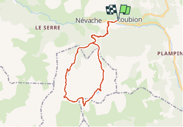
Trail Walking of 17.8 km to be discovered at Provence-Alpes-Côte d'Azur, Hautes-Alpes, Névache. This trail is proposed by nicogex.
Description
Tour depuis nevache en passant par max de l oule col de l oule sommet graniole et lac cristol
Positioning
Country:
France
Region :
Provence-Alpes-Côte d'Azur
Department/Province :
Hautes-Alpes
Municipality :
Névache
Location:
Unknown
Start:(Dec)
Start:(UTM)
312812 ; 4987783 (32T) N.
Comments