


saint-vincent-lutins

jbo1
User
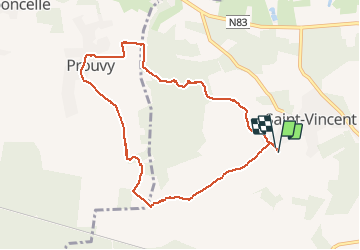

Length
8.4 km

Max alt
390 m

Uphill gradient
93 m
Km-Effort
9.7 km

Min alt
331 m

Downhill gradient
94 m
Boucle
Yes
Creation date :
2020-08-03 08:24:17.191
Updated on :
2020-08-03 12:01:19.213
3h25
Difficulty : Very easy

FREE GPS app for hiking
 SityTrail
IGN / Geographical institutes
SityTrail Plus
The world is yours!
About
Trail Walking of 8.4 km to be discovered at Wallonia, Luxembourg, Tintigny. This trail is proposed by jbo1.
Photos


Positioning
Country:
Belgium
Region :
Wallonia
Department/Province :
Luxembourg
Municipality :
Tintigny
Location:
Saint-Vincent
Start:(Dec)
Start:(UTM)
678202 ; 5505268 (31U) N.
Comments