


reallon lac st appolinaire retour par GR

guariso
User
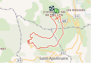

Length
8.9 km

Max alt
1658 m

Uphill gradient
343 m
Km-Effort
13.5 km

Min alt
1396 m

Downhill gradient
350 m
Boucle
Yes
Creation date :
2020-08-05 07:08:24.418
Updated on :
2020-08-05 10:26:20.95
2h56
Difficulty : Easy

FREE GPS app for hiking
 SityTrail
IGN / Geographical institutes
SityTrail Plus
The world is yours!
About
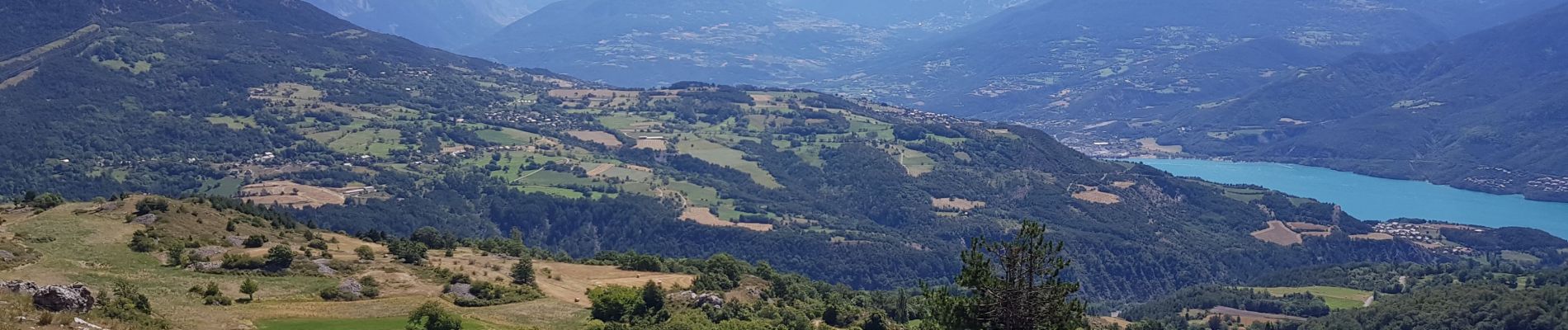
Trail Walking of 8.9 km to be discovered at Provence-Alpes-Côte d'Azur, Hautes-Alpes, Réallon. This trail is proposed by guariso.
Description
randonnée facile dans ce sens, attention l'autre sens est beaucoup plus difficile.
balade très sympa. on a l'impression de descendre tout le temps.
Photos


Positioning
Country:
France
Region :
Provence-Alpes-Côte d'Azur
Department/Province :
Hautes-Alpes
Municipality :
Réallon
Location:
Unknown
Start:(Dec)
Start:(UTM)
290580 ; 4939206 (32T) N.
Comments