


Le pas de la clé

raygautier
User
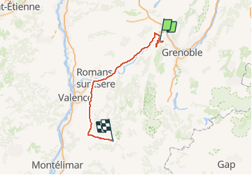

Length
137 km

Max alt
1634 m

Uphill gradient
2592 m
Km-Effort
175 km

Min alt
159 m

Downhill gradient
3436 m
Boucle
No
Creation date :
2020-08-06 07:06:40.0
Updated on :
2020-08-06 20:41:12.002
7h32
Difficulty : Unknown

FREE GPS app for hiking
 SityTrail
IGN / Geographical institutes
SityTrail Plus
The world is yours!
About
Trail Walking of 137 km to be discovered at Auvergne-Rhône-Alpes, Isère, Montaud. This trail is proposed by raygautier.
Positioning
Country:
France
Region :
Auvergne-Rhône-Alpes
Department/Province :
Isère
Municipality :
Montaud
Location:
Unknown
Start:(Dec)
Start:(UTM)
700600 ; 5013083 (31T) N.
Comments