


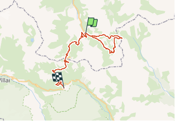
Col des rochiles lac du grand ban lac rond et lac des cerces

nicogex
User

Length
30 km

Max alt
2641 m

Uphill gradient
1388 m
Km-Effort
48 km

Min alt
1963 m

Downhill gradient
1300 m
Boucle
No
Creation date :
2020-08-07 05:15:44.0
Updated on :
2020-08-07 12:28:48.603
6h43
Difficulty : Medium

FREE GPS app for hiking
 SityTrail
IGN / Geographical institutes
SityTrail Plus
The world is yours!
About
Trail Walking of 30 km to be discovered at Auvergne-Rhône-Alpes, Savoy, Valloire. This trail is proposed by nicogex.
Description
Très beau tour avec en fond les aiguilles d’arves
Positioning
Country:
France
Region :
Auvergne-Rhône-Alpes
Department/Province :
Savoy
Municipality :
Valloire
Location:
Unknown
Start:(Dec)
Start:(UTM)
298221 ; 4996149 (32T) N.
Comments