


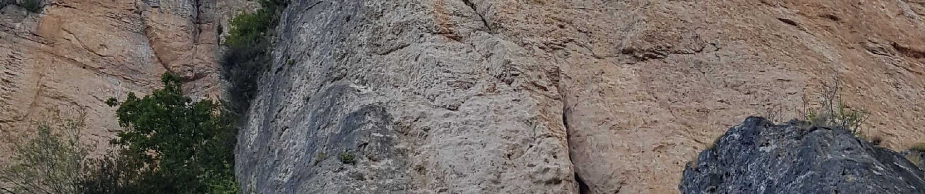
Marche d'approche voie de l'arête décollée , Gorges de la Jonte

Robertplessier
User
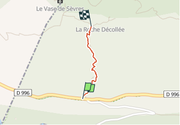

Length
358 m

Max alt
627 m

Uphill gradient
129 m
Km-Effort
1.6 km

Min alt
468 m

Downhill gradient
0 m
Boucle
No
Creation date :
2020-08-09 05:23:59.48
Updated on :
2022-11-08 10:49:07.292
20m
Difficulty : Difficult

FREE GPS app for hiking
 SityTrail
IGN / Geographical institutes
SityTrail Plus
The world is yours!
About
Trail Walking of 358 m to be discovered at Occitania, Lozère, Saint-Pierre-des-Tripiers. This trail is proposed by Robertplessier.
Description
Marche d'approche voie de l'arête décollée , Gorges de la Jonte
Photos


Positioning
Country:
France
Region :
Occitania
Department/Province :
Lozère
Municipality :
Saint-Pierre-des-Tripiers
Location:
Unknown
Start:(Dec)
Start:(UTM)
518408 ; 4893125 (31T) N.
Comments