


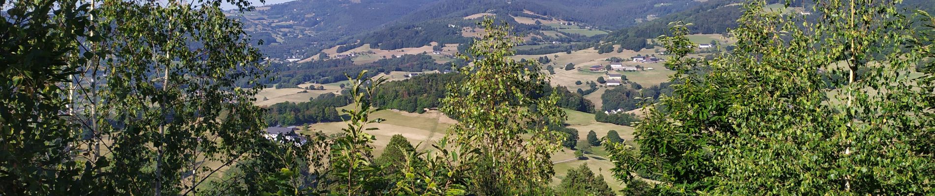
La tour du Faudet

Arnaud Dejean
User
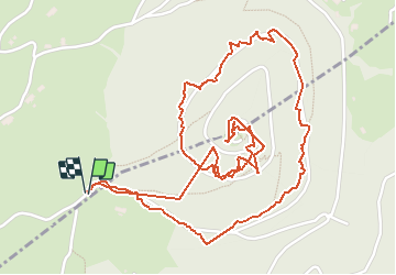

Length
3.7 km

Max alt
764 m

Uphill gradient
122 m
Km-Effort
5.3 km

Min alt
653 m

Downhill gradient
122 m
Boucle
Yes
Creation date :
2020-08-09 07:13:45.729
Updated on :
2020-08-09 09:44:25.354
1h14
Difficulty : Very easy

FREE GPS app for hiking
 SityTrail
IGN / Geographical institutes
SityTrail Plus
The world is yours!
About
Trail Walking of 3.7 km to be discovered at Grand Est, Haut-Rhin, Lapoutroie. This trail is proposed by Arnaud Dejean.
Photos


Positioning
Country:
France
Region :
Grand Est
Department/Province :
Haut-Rhin
Municipality :
Lapoutroie
Location:
Unknown
Start:(Dec)
Start:(UTM)
362925 ; 5333236 (32U) N.
Comments