


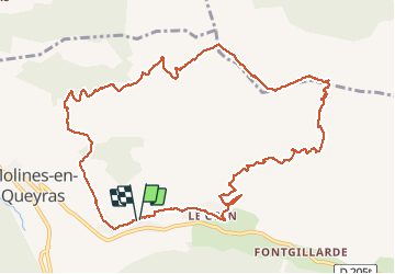
L tour de la gardiole

nicogex
User

Length
12.8 km

Max alt
2787 m

Uphill gradient
918 m
Km-Effort
25 km

Min alt
1917 m

Downhill gradient
932 m
Boucle
Yes
Creation date :
2020-08-09 06:24:00.0
Updated on :
2020-08-09 11:34:31.486
4h21
Difficulty : Difficult

FREE GPS app for hiking
 SityTrail
IGN / Geographical institutes
SityTrail Plus
The world is yours!
About
Trail Walking of 12.8 km to be discovered at Provence-Alpes-Côte d'Azur, Hautes-Alpes, Molines-en-Queyras. This trail is proposed by nicogex.
Positioning
Country:
France
Region :
Provence-Alpes-Côte d'Azur
Department/Province :
Hautes-Alpes
Municipality :
Molines-en-Queyras
Location:
Unknown
Start:(Dec)
Start:(UTM)
330666 ; 4954739 (32T) N.
Comments