


SityTrail - TSN PERSO

UDGI54
User
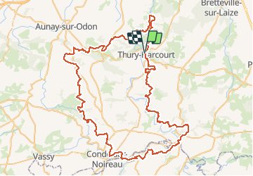

Length
100 km

Max alt
357 m

Uphill gradient
2521 m
Km-Effort
133 km

Min alt
18 m

Downhill gradient
2518 m
Boucle
Yes
Creation date :
2020-08-09 13:37:53.294
Updated on :
2020-08-09 13:37:53.294

FREE GPS app for hiking
 SityTrail
IGN / Geographical institutes
SityTrail Plus
The world is yours!
About
Trail of 100 km to be discovered at Normandy, Calvados, Le Hom. This trail is proposed by UDGI54.
Positioning
Country:
France
Region :
Normandy
Department/Province :
Calvados
Municipality :
Le Hom
Location:
Thury-Harcourt
Start:(Dec)
Start:(UTM)
684577 ; 5428966 (30U) N.
Comments