


Montagny-refuge Creux Lachat

Bogapuki
User
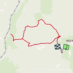

Length
8.9 km

Max alt
1366 m

Uphill gradient
495 m
Km-Effort
15.5 km

Min alt
888 m

Downhill gradient
495 m
Boucle
Yes
Creation date :
2018-11-25 09:19:35.634
Updated on :
2018-11-25 09:19:35.634
3h15
Difficulty : Easy

FREE GPS app for hiking
 SityTrail
IGN / Geographical institutes
SityTrail Plus
The world is yours!
About
Trail Walking of 8.9 km to be discovered at Auvergne-Rhône-Alpes, Savoy, Arith. This trail is proposed by Bogapuki.
Positioning
Country:
France
Region :
Auvergne-Rhône-Alpes
Department/Province :
Savoy
Municipality :
Arith
Location:
Unknown
Start:(Dec)
Start:(UTM)
271652 ; 5066482 (32T) N.
Comments