


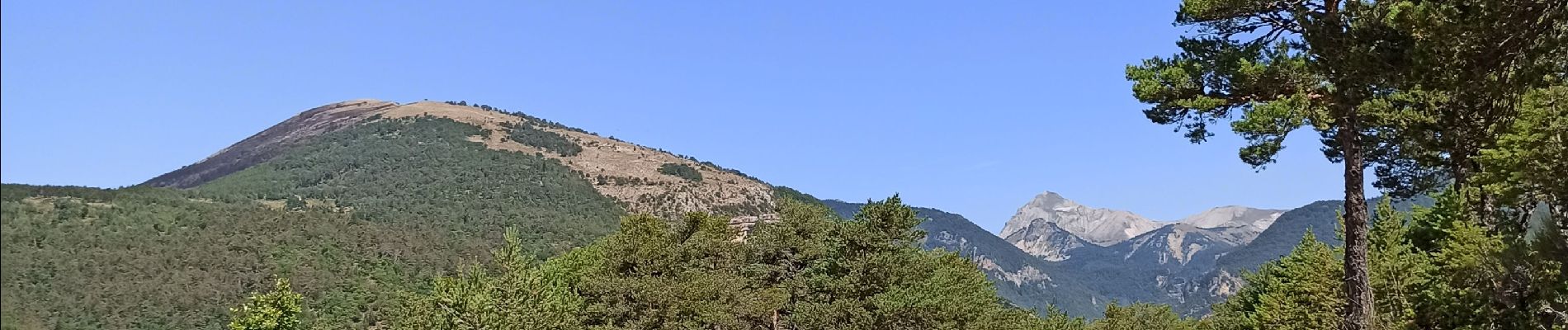
Gorges de l'Agnielle

jeanboulay
User
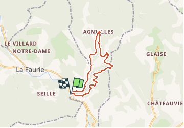

Length
12 km

Max alt
1092 m

Uphill gradient
352 m
Km-Effort
16.7 km

Min alt
809 m

Downhill gradient
346 m
Boucle
Yes
Creation date :
2020-08-11 08:14:00.625
Updated on :
2020-08-11 13:47:13.694
2h25
Difficulty : Medium

FREE GPS app for hiking
 SityTrail
IGN / Geographical institutes
SityTrail Plus
The world is yours!
About
Trail Mountain bike of 12 km to be discovered at Provence-Alpes-Côte d'Azur, Hautes-Alpes, Aspres-sur-Buëch. This trail is proposed by jeanboulay.
Description
Belle randonnée, fin difficile
Photos


Positioning
Country:
France
Region :
Provence-Alpes-Côte d'Azur
Department/Province :
Hautes-Alpes
Municipality :
Aspres-sur-Buëch
Location:
Unknown
Start:(Dec)
Start:(UTM)
719827 ; 4937286 (31T) N.
Comments