


Tour CHATEAURENARD

nicogex
User
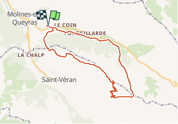

Length
19.6 km

Max alt
2961 m

Uphill gradient
1163 m
Km-Effort
35 km

Min alt
1898 m

Downhill gradient
1161 m
Boucle
Yes
Creation date :
2020-08-10 04:41:36.0
Updated on :
2020-08-11 19:25:15.559
5h35
Difficulty : Difficult

FREE GPS app for hiking
 SityTrail
IGN / Geographical institutes
SityTrail Plus
The world is yours!
About
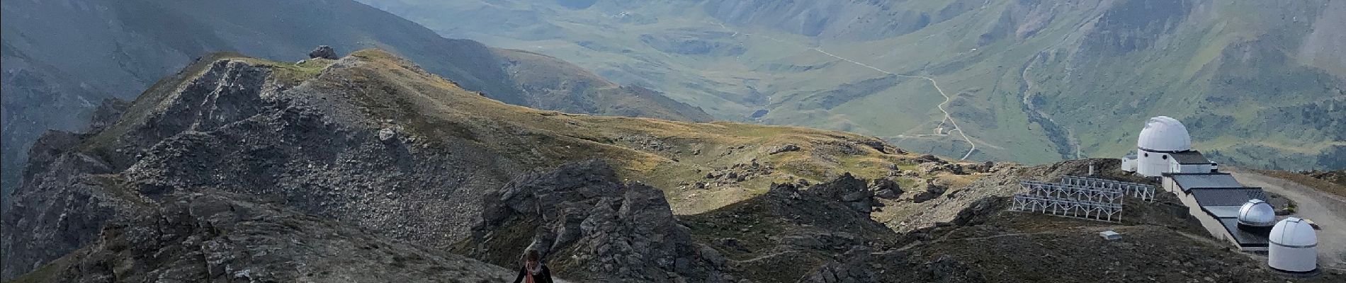
Trail Walking of 19.6 km to be discovered at Provence-Alpes-Côte d'Azur, Hautes-Alpes, Molines-en-Queyras. This trail is proposed by nicogex.
Photos

Positioning
Country:
France
Region :
Provence-Alpes-Côte d'Azur
Department/Province :
Hautes-Alpes
Municipality :
Molines-en-Queyras
Location:
Unknown
Start:(Dec)
Start:(UTM)
330637 ; 4954684 (32T) N.
Comments