


Tour de la tête noire

nicogex
User

Length
25 km

Max alt
3009 m

Uphill gradient
1290 m
Km-Effort
43 km

Min alt
2004 m

Downhill gradient
1513 m
Boucle
No
Creation date :
2020-08-12 06:45:20.0
Updated on :
2020-08-12 16:39:09.052
7h16
Difficulty : Difficult

FREE GPS app for hiking
 SityTrail
IGN / Geographical institutes
SityTrail Plus
The world is yours!
About
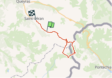
Trail Walking of 25 km to be discovered at Provence-Alpes-Côte d'Azur, Hautes-Alpes, Saint-Véran. This trail is proposed by nicogex.
Description
col blanchet
rocca bianca
col de longet
col de la noire
Positioning
Country:
France
Region :
Provence-Alpes-Côte d'Azur
Department/Province :
Hautes-Alpes
Municipality :
Saint-Véran
Location:
Unknown
Start:(Dec)
Start:(UTM)
333359 ; 4949397 (32T) N.
Comments