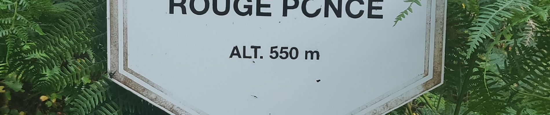
Fagne de Rouge Ponceau

Dirk242
User
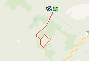

Length
2.6 km

Max alt
548 m

Uphill gradient
34 m
Km-Effort
3 km

Min alt
519 m

Downhill gradient
32 m
Boucle
Yes
Creation date :
2020-08-12 14:23:42.908
Updated on :
2020-08-12 15:17:16.302
41m
Difficulty : Very easy

FREE GPS app for hiking
 SityTrail
IGN / Geographical institutes
SityTrail Plus
The world is yours!
About
Trail Walking of 2.6 km to be discovered at Wallonia, Luxembourg, Tenneville. This trail is proposed by Dirk242.
Description
Knuppelpad door de Venen
Photos


Positioning
Country:
Belgium
Region :
Wallonia
Department/Province :
Luxembourg
Municipality :
Tenneville
Location:
Tenneville
Start:(Dec)
Start:(UTM)
673123 ; 5550448 (31U) N.
Comments