


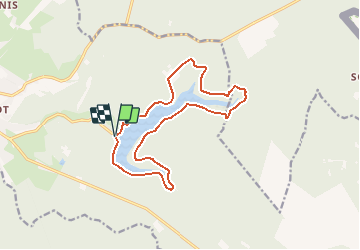
Stuwmeer Eupen

rudgoy
User

Length
13.2 km

Max alt
423 m

Uphill gradient
234 m
Km-Effort
16.3 km

Min alt
346 m

Downhill gradient
229 m
Boucle
Yes
Creation date :
2020-08-16 14:33:01.85
Updated on :
2020-08-16 14:36:43.275
--
Difficulty : Very easy

FREE GPS app for hiking
 SityTrail
IGN / Geographical institutes
SityTrail Plus
The world is yours!
About
Trail Trail of 13.2 km to be discovered at Wallonia, Liège, Eupen. This trail is proposed by rudgoy.
Description
Wandeling rond het stuwmeer van Eupen
Positioning
Country:
Belgium
Region :
Wallonia
Department/Province :
Liège
Municipality :
Eupen
Location:
Eupen (Altgemeinde)
Start:(Dec)
Start:(UTM)
294036 ; 5611299 (32U) N.
Comments