


La Bonette

PhilippeC54
User

Length
46 km

Max alt
2813 m

Uphill gradient
1606 m
Km-Effort
67 km

Min alt
1219 m

Downhill gradient
1606 m
Boucle
Yes
Creation date :
2020-08-20 06:30:28.493
Updated on :
2020-08-20 19:50:14.741
3h02
Difficulty : Difficult

FREE GPS app for hiking
 SityTrail
IGN / Geographical institutes
SityTrail Plus
The world is yours!
About
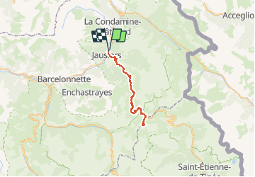
Trail Road bike of 46 km to be discovered at Provence-Alpes-Côte d'Azur, Alpes-de-Haute-Provence, Jausiers. This trail is proposed by PhilippeC54.
Positioning
Country:
France
Region :
Provence-Alpes-Côte d'Azur
Department/Province :
Alpes-de-Haute-Provence
Municipality :
Jausiers
Location:
Unknown
Start:(Dec)
Start:(UTM)
320034 ; 4921428 (32T) N.
Comments