Cussac forêt de cromieres

arnoultjf
User
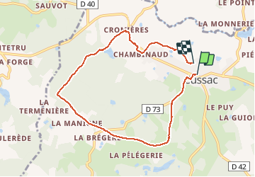

Length
8 km

Max alt
383 m

Uphill gradient
137 m
Km-Effort
9.9 km

Min alt
283 m

Downhill gradient
148 m
Boucle
No
Creation date :
2020-08-25 12:07:28.707
Updated on :
2020-08-25 14:36:28.842
2h28
Difficulty : Very easy

FREE GPS app for hiking
 SityTrail
IGN / Geographical institutes
SityTrail Plus
The world is yours!
About
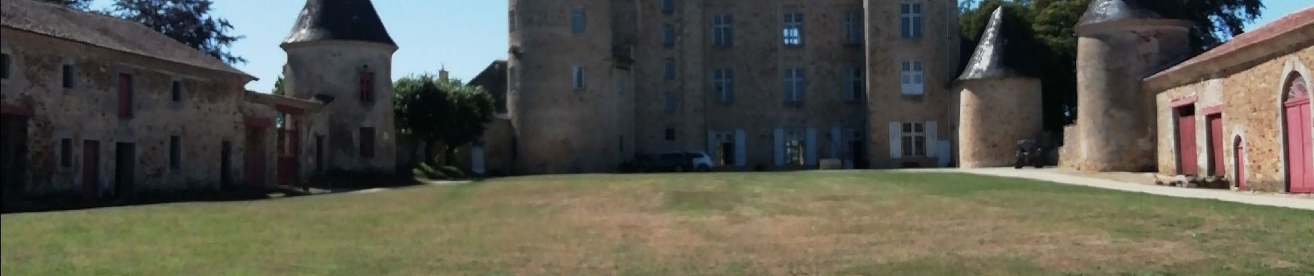
Trail Walking of 8 km to be discovered at New Aquitaine, Haute-Vienne, Cussac. This trail is proposed by arnoultjf.
Photos


Positioning
Country:
France
Region :
New Aquitaine
Department/Province :
Haute-Vienne
Municipality :
Cussac
Location:
Unknown
Start:(Dec)
Start:(UTM)
332703 ; 5063640 (31T) N.
Comments