


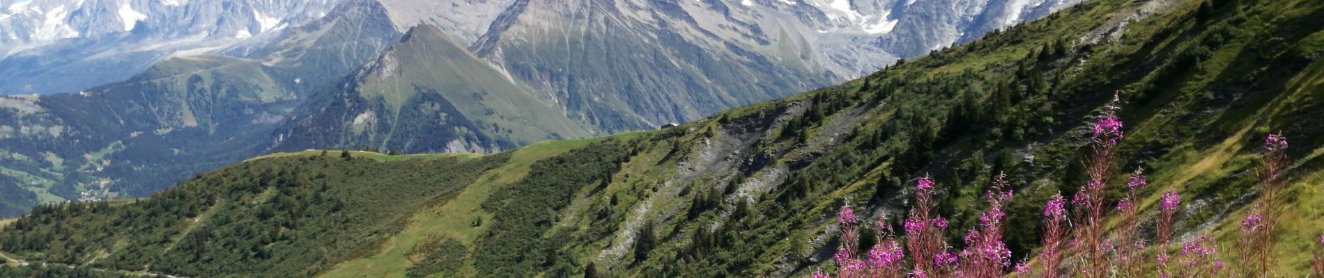
Mont JOLY

Jean-Paulchoux
User
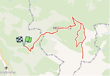

Length
12.8 km

Max alt
2497 m

Uphill gradient
1040 m
Km-Effort
27 km

Min alt
1444 m

Downhill gradient
1042 m
Boucle
Yes
Creation date :
2020-08-26 07:12:11.774
Updated on :
2020-08-27 08:25:46.245
4h11
Difficulty : Medium

FREE GPS app for hiking
 SityTrail
IGN / Geographical institutes
SityTrail Plus
The world is yours!
About
Trail Walking of 12.8 km to be discovered at Auvergne-Rhône-Alpes, Upper Savoy, Megève. This trail is proposed by Jean-Paulchoux.
Photos


Positioning
Country:
France
Region :
Auvergne-Rhône-Alpes
Department/Province :
Upper Savoy
Municipality :
Megève
Location:
Unknown
Start:(Dec)
Start:(UTM)
318261 ; 5077931 (32T) N.
Comments