


Le lac de la patinoire en partant de Pralognan

franquen
User
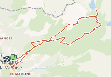

Length
13.6 km

Max alt
2590 m

Uphill gradient
1482 m
Km-Effort
33 km

Min alt
1408 m

Downhill gradient
1478 m
Boucle
Yes
Creation date :
2020-08-27 06:58:46.879
Updated on :
2020-08-27 15:14:33.088
5h16
Difficulty : Easy

FREE GPS app for hiking
 SityTrail
IGN / Geographical institutes
SityTrail Plus
The world is yours!
About
Trail Walking of 13.6 km to be discovered at Auvergne-Rhône-Alpes, Savoy, Pralognan-la-Vanoise. This trail is proposed by franquen.
Description
Très belle rando dans le parc de la Vanoise . le glacier de la grande Casse est majestueux.
Départ et arrivée par le téléphérique du Bochor , il faut donc enlever 600m aux dénivelés cumulés.
Positioning
Country:
France
Region :
Auvergne-Rhône-Alpes
Department/Province :
Savoy
Municipality :
Pralognan-la-Vanoise
Location:
Unknown
Start:(Dec)
Start:(UTM)
321541 ; 5027925 (32T) N.
Comments