


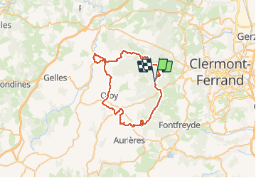
Tour des Dômes

alinetpierre
User

Length
61 km

Max alt
1462 m

Uphill gradient
1746 m
Km-Effort
84 km

Min alt
675 m

Downhill gradient
1742 m
Boucle
Yes
Creation date :
2020-08-25 07:47:12.0
Updated on :
2020-08-27 13:29:47.941
15h19
Difficulty : Medium

FREE GPS app for hiking
 SityTrail
IGN / Geographical institutes
SityTrail Plus
The world is yours!
About
Trail Walking of 61 km to be discovered at Auvergne-Rhône-Alpes, Puy-de-Dôme, Orcines. This trail is proposed by alinetpierre.
Description
Tour des dômes départ col de Ceyssat , plus pr bleu à Mazaye car 2 eme jour trop court denier jour passage par le sommet du puy de Côme, seul passage difficile à la descente.
Positioning
Country:
France
Region :
Auvergne-Rhône-Alpes
Department/Province :
Puy-de-Dôme
Municipality :
Orcines
Location:
Unknown
Start:(Dec)
Start:(UTM)
496653 ; 5067813 (31T) N.
Comments