


Grenoble Dent de Crolle 26 août 2020 CAF Ecrins

TRIMAILLE
User
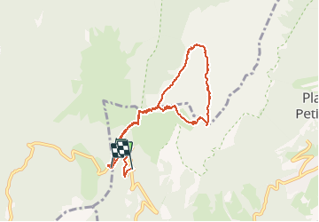

Length
8.9 km

Max alt
2038 m

Uphill gradient
682 m
Km-Effort
18.4 km

Min alt
1330 m

Downhill gradient
798 m
Boucle
No
Creation date :
2020-08-26 06:43:58.033
Updated on :
2020-09-14 16:03:12.295
2h26
Difficulty : Very easy

FREE GPS app for hiking
 SityTrail
IGN / Geographical institutes
SityTrail Plus
The world is yours!
About
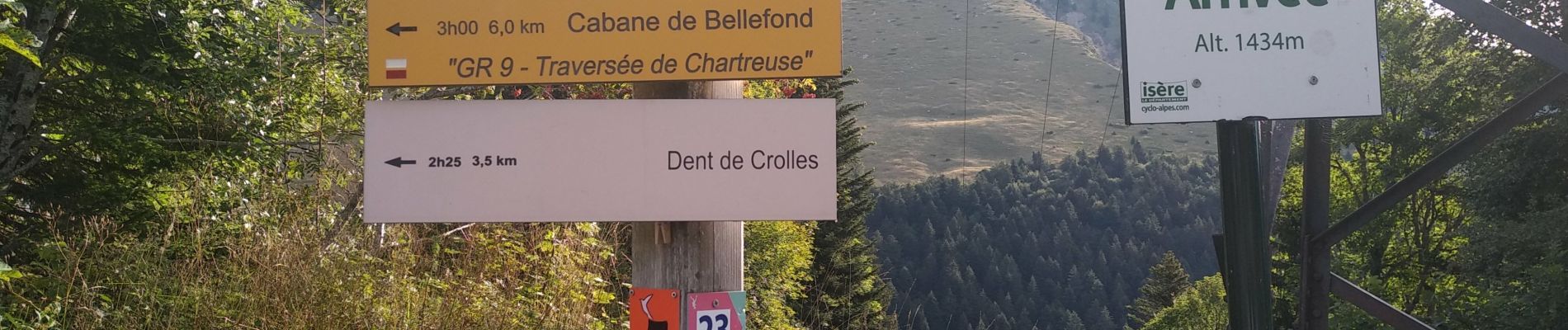
Trail Walking of 8.9 km to be discovered at Auvergne-Rhône-Alpes, Isère, Saint-Pierre-de-Chartreuse. This trail is proposed by TRIMAILLE.
Photos


Positioning
Country:
France
Region :
Auvergne-Rhône-Alpes
Department/Province :
Isère
Municipality :
Saint-Pierre-de-Chartreuse
Location:
Unknown
Start:(Dec)
Start:(UTM)
722396 ; 5020471 (31T) N.
Comments