


10499428-track-1598562033-120

olivier26
User
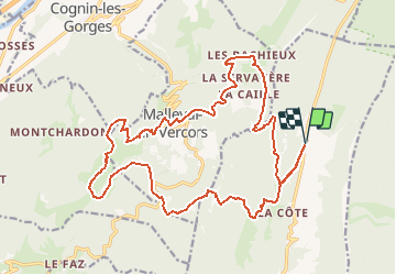

Length
24 km

Max alt
1449 m

Uphill gradient
1136 m
Km-Effort
39 km

Min alt
873 m

Downhill gradient
1136 m
Boucle
Yes
Creation date :
2020-08-27 21:03:57.498
Updated on :
2020-08-27 21:06:55.246
--
Difficulty : Unknown

FREE GPS app for hiking
 SityTrail
IGN / Geographical institutes
SityTrail Plus
The world is yours!
About
Trail Trail of 24 km to be discovered at Auvergne-Rhône-Alpes, Isère, Rencurel. This trail is proposed by olivier26.
Positioning
Country:
France
Region :
Auvergne-Rhône-Alpes
Department/Province :
Isère
Municipality :
Rencurel
Location:
Unknown
Start:(Dec)
Start:(UTM)
694931 ; 5001807 (31T) N.
Comments