


20200901-St Aubin les Elbeuf Cool

doudet
User
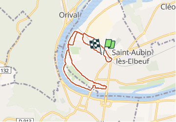

Length
7.4 km

Max alt
17 m

Uphill gradient
38 m
Km-Effort
7.9 km

Min alt
2 m

Downhill gradient
37 m
Boucle
Yes
Creation date :
2020-09-01 07:32:50.754
Updated on :
2020-09-01 13:47:49.113
1h49
Difficulty : Easy

FREE GPS app for hiking
 SityTrail
IGN / Geographical institutes
SityTrail Plus
The world is yours!
About
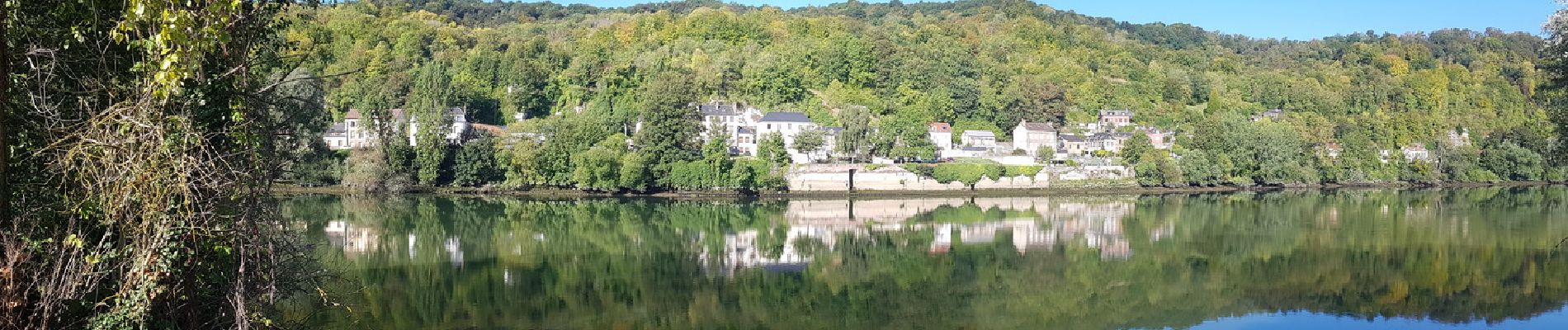
Trail Walking of 7.4 km to be discovered at Normandy, Seine-Maritime, Saint-Aubin-lès-Elbeuf. This trail is proposed by doudet.
Description
Boucle A-R au départ de la gare de St Aubin
Photos


Positioning
Country:
France
Region :
Normandy
Department/Province :
Seine-Maritime
Municipality :
Saint-Aubin-lès-Elbeuf
Location:
Unknown
Start:(Dec)
Start:(UTM)
355300 ; 5463050 (31U) N.
Comments
