


2

elorthiois
User
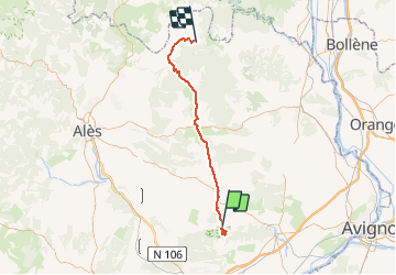

Length
57 km

Max alt
333 m

Uphill gradient
1010 m
Km-Effort
70 km

Min alt
38 m

Downhill gradient
893 m
Boucle
No
Creation date :
2020-09-01 06:58:53.835
Updated on :
2020-09-01 15:27:31.92
8h27
Difficulty : Medium

FREE GPS app for hiking
 SityTrail
IGN / Geographical institutes
SityTrail Plus
The world is yours!
About
Trail Walking of 57 km to be discovered at Occitania, Gard, Sanilhac-Sagriès. This trail is proposed by elorthiois.
Description
2020 09 01 St Veredeme et la baume
Positioning
Country:
France
Region :
Occitania
Department/Province :
Gard
Municipality :
Sanilhac-Sagriès
Location:
Unknown
Start:(Dec)
Start:(UTM)
614359 ; 4867680 (31T) N.
Comments