


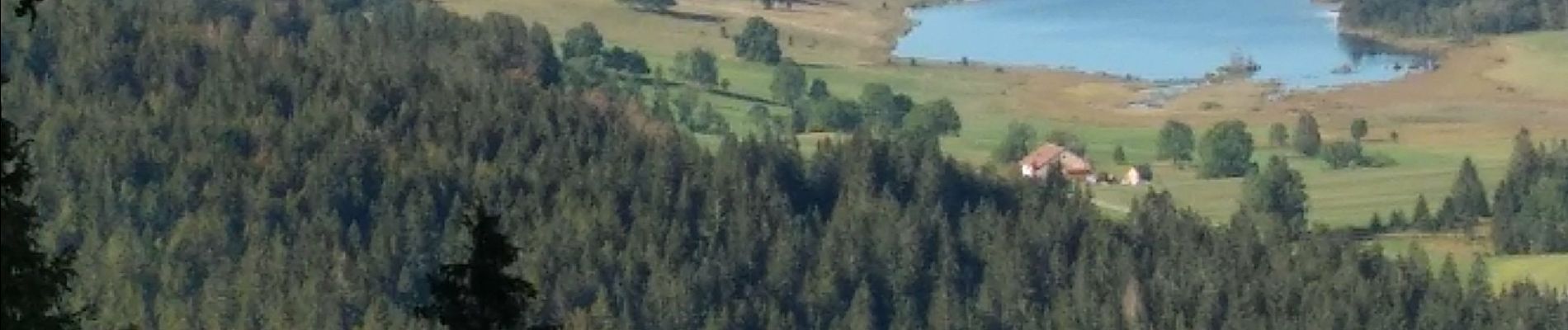
Chapelle des Bois Lac des Mortes 3 sept 2020 CAF

TRIMAILLE
User

Length
24 km

Max alt
1350 m

Uphill gradient
704 m
Km-Effort
34 km

Min alt
1054 m

Downhill gradient
703 m
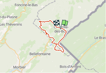
Boucle
Yes
Creation date :
2020-09-03 07:26:57.374
Updated on :
2020-09-14 15:47:45.275
5h40
Difficulty : Difficult

FREE GPS app for hiking
 SityTrail
IGN / Geographical institutes
SityTrail Plus
The world is yours!
About
Trail Walking of 24 km to be discovered at Bourgogne-Franche-Comté, Doubs, Chapelle-des-Bois. This trail is proposed by TRIMAILLE.
Photos


Positioning
Country:
France
Region :
Bourgogne-Franche-Comté
Department/Province :
Doubs
Municipality :
Chapelle-des-Bois
Location:
Unknown
Start:(Dec)
Start:(UTM)
278941 ; 5164481 (32T) N.
Comments