


Montgenevre

Daniel Benteux
User
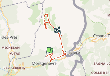

Length
14.1 km

Max alt
2450 m

Uphill gradient
721 m
Km-Effort
23 km

Min alt
1834 m

Downhill gradient
648 m
Boucle
No
Creation date :
2020-09-02 14:39:21.496
Updated on :
2020-09-03 16:51:22.858
8h23
Difficulty : Medium

FREE GPS app for hiking
 SityTrail
IGN / Geographical institutes
SityTrail Plus
The world is yours!
About
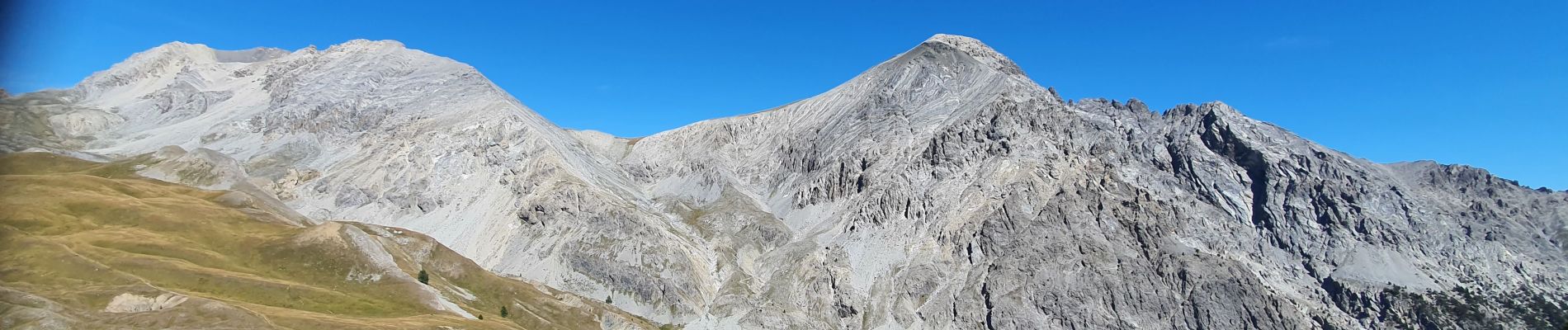
Trail Walking of 14.1 km to be discovered at Provence-Alpes-Côte d'Azur, Hautes-Alpes, Montgenèvre. This trail is proposed by Daniel Benteux.
Description
moyen
Photos


Positioning
Country:
France
Region :
Provence-Alpes-Côte d'Azur
Department/Province :
Hautes-Alpes
Municipality :
Montgenèvre
Location:
Unknown
Start:(Dec)
Start:(UTM)
320104 ; 4978259 (32T) N.
Comments